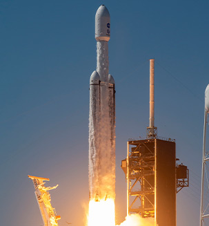
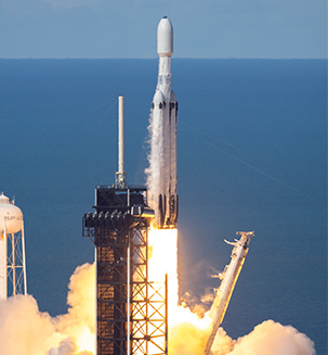
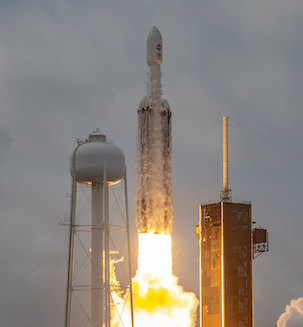
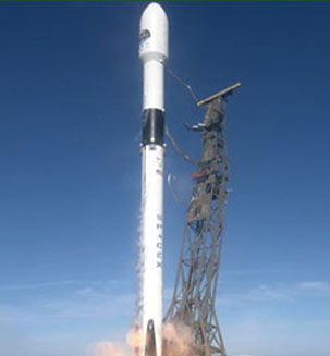
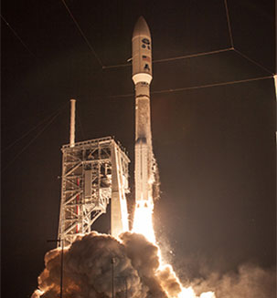
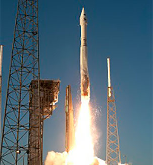
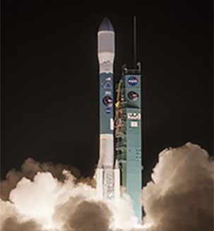
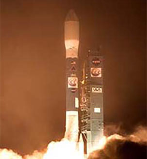
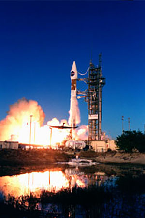
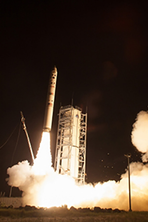
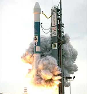
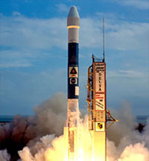
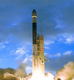
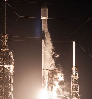
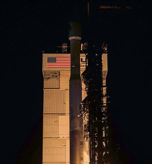
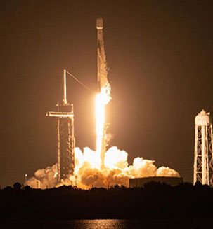
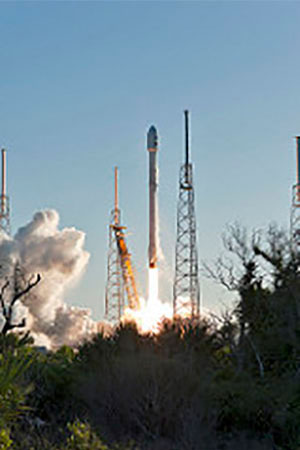
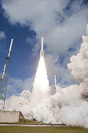
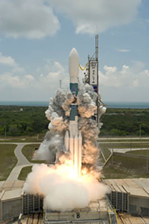
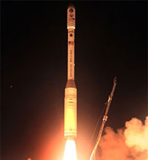
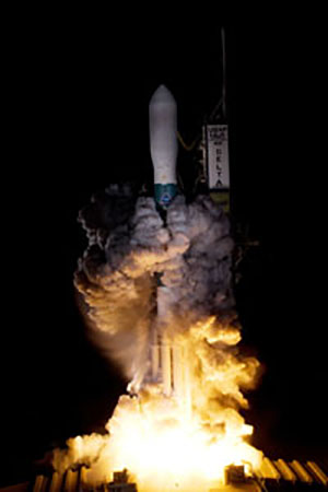
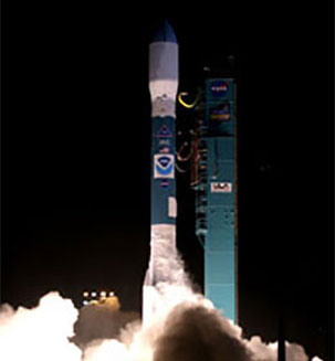
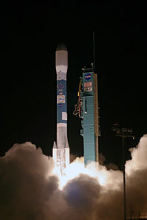
NASA’s Europa Clipper has embarked on its long voyage to Jupiter, where it will investigate Europa, a moon with an enormous subsurface ocean that may have conditions to support life. The spacecraft launched at 12:06 p.m. EDT Monday aboard a SpaceX Falcon Heavy rocket from Launch Pad 39A at NASA’s Kennedy Space Center in Florida.
Europa Clipper is the first NASA mission dedicated to studying an ocean world beyond Earth. The main goal of the mission is to determine whether Europa has conditions that could support life. Europa is about the size of our own Moon, but its interior is different. Information from NASA’s Galileo mission in the 1990s showed strong evidence that under Europa’s ice lies an enormous, salty ocean with more water than all of Earth’s oceans combined. Scientists also have found evidence that Europa may host organic compounds and energy sources under its surface.
NASA’s Geostationary Operational Environmental Satellite-U (GOES-U) mission launched at 5:26 p.m. EST on Tuesday, June 25, 2024, on a SpaceX Falcon Heavy rocket from NASA’s Kennedy Space Center in Florida. GOES-U is the fourth and final satellite in a series of advanced weather satellites for NOAA (National Oceanic and Atmospheric Administration). Since reaching geostationary orbit at 22,236 miles above Earth, GOES-U has been renamed GOES-19. GOES-19 will benefit the nation and other parts of the world by providing continuous coverage of weather and hazardous environmental conditions over most of North America, including the contiguous United States and Mexico, as well as Central and South America, the Caribbean, and the Atlantic Ocean to the west coast of Africa. In addition to its critical role in terrestrial weather prediction, the GOES constellation of satellites helps forecasters predict space weather near Earth that can interfere with satellite electronics, GPS, and radio communications.
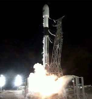
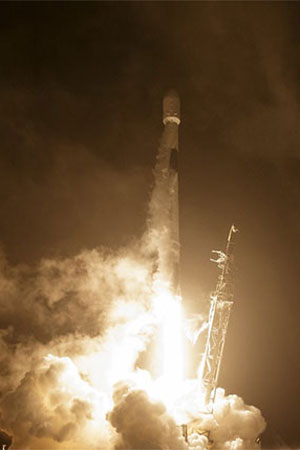
Known as PACE, the Plankton, Aerosol, Cloud, ocean Ecosystem satellite, launched aboard a SpaceX Falcon 9 rocket from Space Launch Complex 40 at Cape Canaveral Space Force Station in Florida. NASA confirmed signal acquisition from the satellite about five minutes after launch, and the spacecraft is performing as expected.
From hundreds of miles above Earth, the PACE mission will study the impact of tiny, often invisible things: microscopic life in water and microscopic particles in the air.
The satellite’s hyperspectral ocean color instrument will allow researchers to measure oceans and other waterbodies across a spectrum of ultraviolet, visible, and near-infrared light. This will enable scientists to track the distribution of phytoplankton and – for the first time from space – identify which communities of these organisms are present on daily, global scales. Scientists and coastal resource managers can use the data to help forecast the health of fisheries, track harmful algal blooms, and identify changes in the marine environment.
Psyche successfully launched October 13, 2023, at 10:19 a.m. EDT aboard a SpaceX Falcon Heavy rocket from Launch Pad 39A at NASA’s Kennedy Space Center in Florida. NASA’s Psyche spacecraft is on its voyage to an asteroid of the same name, a metal-rich world that could tell us more about the formation of rocky planets. Upon arrival, the spacecraft will begin to orbit the 173-mile-wide (279-kilometer-wide) asteroid – the only metal-class asteroid ever to be explored. Because of Psyche’s high iron-nickel metal content, scientists think it may be the partial core of a planetesimal, a building block of an early planet. This may offer a unique window into the violent history of collisions and accretion that created terrestrial planets.
The Surface Water and Ocean Topography (SWOT) satellite built for NASA and the French space agency Centre National d’Études Spatiales (CNES) to observe nearly all the water on our planet’s surface lifted off on its way to low-Earth orbit on December 16, 2022. The SWOT spacecraft also has contributions from the Canadian Space Agency (CSA) and the UK Space Agency.
The SWOT spacecraft launched atop a SpaceX rocket from Space Launch Complex 4E at Vandenberg Space Force Base in California with a prime mission of three years. The satellite will measure the height of water in freshwater bodies and the ocean on more than 90% of Earth’s surface. This information will provide insights into how the ocean influences climate change; how a warming world affects lakes, rivers, and reservoirs; and how communities can better prepare for disasters, such as floods.
NA
NA
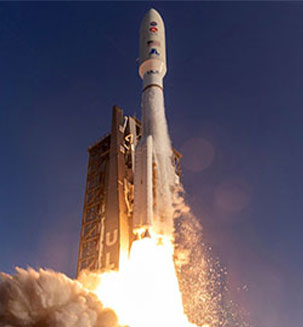
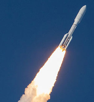
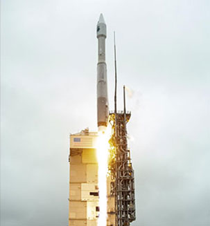
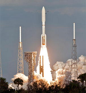
On November 10, 2022, NASA successfully launched the newest Joint Polar Satellite System or JPSS-2 for the National Oceanic and Atmospheric Administration (NOAA) at 1:49 a.m. PST (4:49 a.m. EST) on a United Launch Alliance Atlas V rocket from Vandenberg Space Force Base in California. JPSS-2 is the third in a series of polar-orbiting weather satellites.
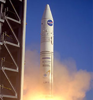
In addition to JPSS-2, also aboard was NASA’s Low-Earth Orbit Flight Test of an Inflatable Decelerator, or LOFTID, a test of inflatable heat shield technology that could one day help land astronauts on Mars.
This launch marked the 100th mission for NASA's Launch Services Program (LSP). Additionally, this was the final Atlas V launch for LSP, as well as, the last time an Atlas V rocket will launch from Vandenberg Space Fore Base.
NA
NA
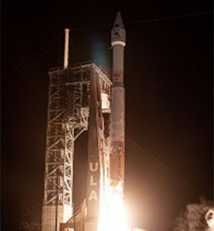
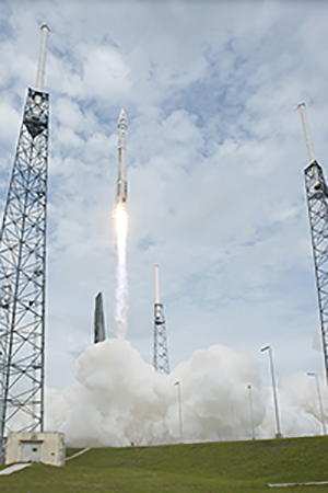
NASA’s Geostationary Operational Environmental Satellite-T (GOES-T) mission launched at 4:38 p.m. EST on Tuesday, March 1, 2022, on a United Launch Alliance Atlas V 541 rocket from Cape Canaveral Space Force Station in Florida.
A joint effort between NASA and NOAA, GOES-T was renamed GOES-18 once it reached geostationary orbit, replacing GOES-17 as GOES West. It is positioned to watch over the western contiguous United States, Alaska, Hawaii, Mexico, Central America, and the Pacific Ocean. The satellite is ideally located to monitor weather systems and hazards that most affect this region of the Western Hemisphere.
NA
NA
NASA’s Imaging X-ray Polarimetry Explorer (IXPE) mission launched at 1 a.m. EST Thursday, December 9, 2021, on a SpaceX Falcon 9 rocket from Cape Canaveral Space Force Station in Florida.
A joint effort with the Italian Space Agency, the IXPE observatory is NASA’s first mission dedicated to measuring the polarization of X-rays from the most extreme and mysterious objects in the universe – supernova remnants, supermassive black holes, and dozens of other high-energy objects. Some of the technical and science objectives include improving polarization sensitivity, providing simultaneous spectral, spatial, and temporal measurements, determining how particles are accelerated in Pulsar Wind Nebulae, among others.
NA
NA
NASA’s Double Asteroid Redirection Test (DART), the world’s first full-scale mission to test technology for defending Earth against potential asteroid or comet hazards, launched on November 23, 2021 from Vandenberg Space Force Base in California. As part of NASA’s larger planetary defense strategy, DART will impact a known asteroid that is not a threat to Earth. DART will be the first demonstration of the kinetic impactor technique with the goal of slightly changing the asteroid’s motion in a way that can be accurately measured using ground-based telescopes.
NA
NA
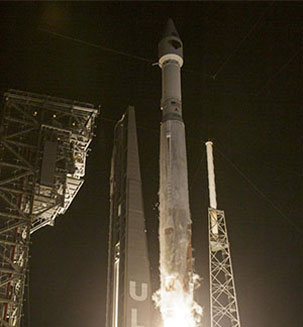
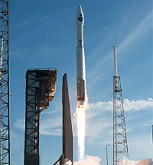
NASA’s Lucy mission, the agency’s first to Jupiter’s Trojan asteroids, launched at 5:34 a.m. EDT Saturday, October 16, 2021, on a United Launch Alliance (ULA) Atlas V rocket from Space Launch Complex 41 at Cape Canaveral Space Force Station in Florida.
Over the course of the mission, Lucy will fly by one main-belt asteroid and seven Trojan asteroids, making it the agency’s first single spacecraft mission in history to explore so many different asteroids. Lucy will investigate these “fossils” of planetary formation up close during its journey.
Named for the fossilized skeleton of one of our earliest known hominin ancestors, the Lucy mission will allow scientists to explore two swarms of Trojan asteroids that share an orbit around the Sun with Jupiter. Scientific evidence indicates that Trojan asteroids are remnants of the material that formed giant planets. Studying them can reveal previously unknown information about their formation and our solar system’s evolution in the same way the fossilized skeleton of Lucy revolutionized our understanding of human evolution.
NA
NA
Landsat 9 - a partnership between NASA and the U.S. Geological Survey - will extend our ability to measure changes on the global land surface at a scale where we can separate human and natural causes of change. Landsat 9 will continue the Landsat program's critical role in monitoring, understanding and managing the land resources needed to sustain human life by providing data that will help decision makers make informed management decisions.
Landsat 9 will thus contribute a critical component to the international strategy for monitoring the health and state of the Earth. Applications such as weekly tropical deforestation alerts, water quality monitoring, and crop condition reports are now feasible with the constellation. With increased activity in international and commercial remote sensing, Landsat has emerged as a cornerstone of the global constellation of imagers.
NA
NA
The Sentinel-6 Michael Freilich satellite is a collaboration between the European Space Agency (ESA), the European Commission, the European Organisation for the Exploitation of Meteorological Satellites (EUMETSAT), NASA and the U.S. National Oceanic and Atmospheric Administration (NOAA). Sentinel-6 Michael Freilich was named in honor of the late Dr. Michael Freilich, who was instrumental in advancing ocean altimetry while leading NASA’s Earth Science Division.
Sentinel-6 Michael Freilich is a “game changer” because it will ensure continuity of sea level observations for at least a decade. Like their predecessors, these satellites will provide ongoing measurements of global sea level rise – one of the most important impacts of human-caused climate change. The data will also support operational oceanography, improving forecasts of ocean currents as well as wind and wave conditions. In addition, it will help to improve forecasts of weather conditions likely to prevail two to four weeks ahead (e.g., hurricane intensity forecasting). Sentinel-6 Michael Freilich will also aid weather prediction through a new experiment: Global Navigation Satellite System Radio Occultation (GNSS-RO). Watching GNSS satellites as they disappear over the horizon will provide detailed information about the layers in the atmosphere. This information will contribute to computer models that predict the weather and enhance forecasting capabilities.
NA
NA
The Mars 2020 rover, Perseverance, is based on the Mars Science Laboratory’s Curiosity rover configuration. It is car-sized, about 10 feet long (not including the arm), 9 feet wide, and 7 feet tall (about 3 meters long, 2.7 meters wide, and 2.2 meters tall). But at 2,260 pounds (1,025 kilograms), it weighs less than a compact car. In some sense, the rover parts are similar to what any living creature would need to keep it “alive” and able to explore.
NASA’s Launch Services Program based at Kennedy managed the launch which occurred on July 30, 2020 from Cape Canaveral Air Force Station. On February 18, 2021 Perseverance landed on Mars at the Jezero Crater. Perseverance was developed under NASA’s Mars Exploration Program, and her mission is to search for signs of past microbial life, characterize the planet’s climate and geology, collect samples for future return to Earth and pave the way for human exploration of Mars.
NA
NA
Solar Orbiter is an international cooperative mission between ESA (the European Space Agency) and NASA that addresses a central question of heliophysics: How does the Sun create and control the constantly changing space environment throughout the solar system? The Sun creates what’s known as the heliosphere — a giant bubble of charged particles and magnetic fields blown outward by the Sun that stretches more than twice the distance to Pluto at its nearest edge, enveloping every planet in our solar system and shaping the space around us. To understand it, Solar Orbiter will travel as close as 26 million miles from the Sun, inside the orbit of Mercury. There, it will measure the magnetic fields, waves, energetic particles and plasma escaping the Sun while they are in their pristine state, before being modified and mixed in their long journey from the Sun.
NA
NA
The Ionospheric Connection Explorer will study the frontier of space: the dynamic zone high in our atmosphere where terrestrial weather from below meets space weather above. In this region, the tenuous gases are anything but quiet, as a mix of neutral and charged particles travel through in giant winds. These winds can change on a wide variety of time scales -- due to Earth's seasons, the day's heating and cooling, and incoming bursts of radiation from the sun. ICON will help determine the physics of our space environment and pave the way for mitigating its effects on our technology, communications systems and society.
NA
NA
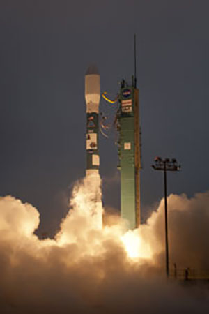
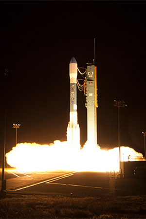
The Ice, Cloud and land Elevation Satellite-2, or ICESat-2, will measure the height of a changing Earth – one laser pulse at a time, 10,000 laser pulses a second. ICESat-2 will carry a laser altimeter that detects individual photons, allowing scientists to measure the elevation of ice sheets, sea ice, forests and more in unprecedented detail. Our planet's frozen and icy areas, called the cryosphere, are a key focus of NASA's Earth science research. ICESat-2 will help scientists investigate why, and how much, our cryosphere is changing in a warming climate. The satellite will also measure heights across Earth's temperate and tropical regions, and take stock of the vegetation in forests worldwide. ICESat-2 launched aboard the last Delta II Launch Vehicle on September 15, 2018 at 6:02am PDT from Vandenberg Air Force Base.
NA
NA
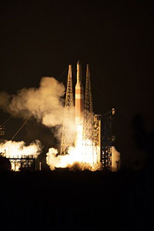
NASA’s Parker Solar Probe (PSP) will be the first-ever mission to "touch" the sun. The spacecraft, about the size of a small car, will travel directly into the sun's atmosphere about 4 million miles from our star's surface. NASA's historic PSP mission will revolutionize our understanding of the sun, where changing conditions can propagate out into the solar system, affecting Earth and other worlds. Parker Solar Probe will travel through the sun’s atmosphere, closer to the surface than any spacecraft before it, facing brutal heat and radiation conditions — and ultimately providing humanity with the closest-ever observations of a star. PSP launched aboard a United Launch Alliance Delta IV-Heavy with Upper Stage from Cape Canaveral Air Force Station at 3:31AM EST on August 12, 2018.
NA
NA
InSight (Interior Exploration using Seismic Investigations, Geodesy and Heat Transport), the first mission to explore Mars' deep interior, launched May 5th, 2018 at 4:05AM PDT, from Vandenberg Air Force Base on a ULA Atlas V rocket. It will investigate processes that shaped the rocky planets of the inner solar system (including Earth) more than four billion years ago. By using sophisticated geophysical instruments, InSight will delve deep beneath the surface of Mars, detecting the fingerprints of the processes of terrestrial planet formation, as well as measuring the planet's "vital signs": Its "pulse" (seismology), "temperature" (heat flow probe), and "reflexes" (precision tracking).
https://images-assets.nasa.gov/video/launch/launch~orig.mp4
https://public.ksc.nasa.gov/lsphistory/wp-content/uploads/sites/26/2023/05/ launch.srt.vtt
The Transiting Exoplanet Survey Satellite (TESS) is the next step in the search for planets outside of our solar system, including those that could support life. The mission will find exoplanets that periodically block part of the light from their host stars, events called transits. TESS will survey 200,000 of the brightest stars near the sun to search for transiting exoplanets. TESS scientists expect the mission will catalog more than 2,000 planet candidates and vastly increase the current number of known exoplanets. Of these, approximately 300 are expected to be Earth-sized and super-Earth-sized exoplanets, which are worlds no larger than twice the size of Earth. TESS will find the most promising exoplanets orbiting our nearest and brightest stars, giving future researchers a rich set of new targets for more comprehensive follow-up studies. TESS launched from Cape Canaveral Air Force Station on a SpaceX Falcon 9 rocket April 18, 2018 at 6:51PM EDT.
https://images-assets.nasa.gov/video/TESS/TESS~orig.mp4
https://public.ksc.nasa.gov/lsphistory/wp-content/uploads/sites/26/2023/05/TESS.vtt
NOAA’s Geostationary Operational Environmental Satellite-S (GOES-S) launched March 1, 2018 at 5:02 p.m. EST on a United Launch Alliance Atlas V rocket from Cape Canaveral Air Force Station (CCAFS) in Florida. GOES-S is the second in the GOES-R Series of weather satellites that includes GOES-R (now GOES-16), -S, -T and -U. GOES-S will be renamed GOES-17 when it reaches geostationary orbit. Once the satellite is declared operational late 2018, it will occupy NOAA’s GOES-West position and provide faster, more accurate data for tracking wildfires, tropical cyclones, fog and other storm systems and hazards that threaten the western United States, Hawaii, Alaska, Mexico, Central America and part of South America.
https://images-assets.nasa.gov/video/GOES-S/GOES-S~orig.mp4
https://public.ksc.nasa.gov/lsphistory/wp-content/uploads/sites/26/2023/05/GOES-S.vtt
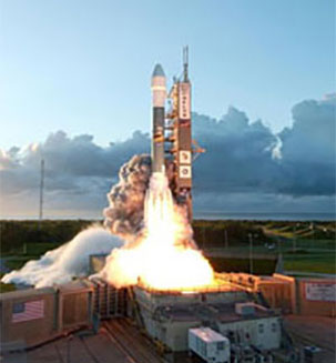
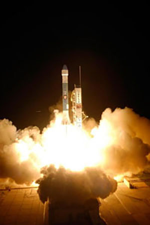
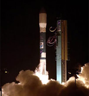
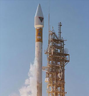
JPSS-1, or NOAA-20 as known once operational, is the second spacecraft within NOAA's next generation of polar-orbiting satellites. Capitalizing on the success of Suomi NPP, the JPSS-1 spacecraft boasts five similar instruments: (1) VIIRS, (2) CrIS, (3) ATMS, (4) OMPS-N, and (5) CERES-FM6. Instruments can also be called sensors or payloads. JPSS-1 will take advantage of the successful technologies developed through the Suomi NPP satellite. JPSS-1's design life is seven years. JPSS-1 lifted off from Vandenberg Air Force Base in California November 18, 2017 at 1:47 a.m. PST (4:47 a.m. EST) aboard a Delta II rocket.
NA
NA
Without the Space Network, scientists, engineers and control room staff would be unable to readily access data from missions like the Hubble Space Telescope and the International Space Station. The spacecraft launched from NASA’s Kennedy Space Center in Cape Canaveral, Florida, on August 18, 2017, at 8:29 a.m. EDT on an Atlas V rocket.
NA
NA
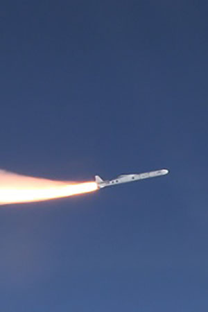
Hurricane forecasters will soon have a new tool to better understand and forecast storm intensity. A constellation of eight microsatellites, called NASA’s Cyclone Global Navigation Satellite System (CYGNSS) got a boost into Earth orbit at 8:37 a.m. EDT December 15, 2016 aboard Orbital ATK Pegasus XL rocket. The CYGNSS mission will measure wind speeds over Earth's oceans, increasing the ability of scientists to understand and predict hurricanes. Each satellite will take information based on the signals from four GPS satellites.
https://images-assets.nasa.gov/video/CYGNSS/CYGNSS~orig.mp4
https://public.ksc.nasa.gov/lsphistory/wp-content/uploads/sites/26/2023/05/CYGNSS.vtt
The Geostationary Operational Environmental Satellite-R Series (GOES-R) is the next generation of geostationary weather satellites, planned for launch in 2016. The advanced spacecraft and instrument technology used on the GOES-R series will result in more timely and accurate forecasts and warnings. It will improve support for the detection and observations of meteorological phenomena that directly affect public safety, protection of property, and ultimately, economic health and development.
https://images-assets.nasa.gov/video/GOES-R/GOES-R~orig.mp4
https://public.ksc.nasa.gov/lsphistory/wp-content/uploads/sites/26/2023/05/GOES-R.vtt
The Origins, Spectral Interpretation, Resource Identification, Security-Regolith Explorer (OSIRIS-REx) spacecraft NASA’s first asteroid sampling mission launched into space at 7:05 p.m. EDT Thursday, September 8, 2016 from Cape Canaveral Air Force Station in Florida, beginning a journey that could revolutionize our understanding of the early solar system. The mission will help scientists investigate how planets formed and how life began, as well as improve our understanding of asteroids that could impact Earth. The spacecraft will reach its asteroid target in 2018 and return a sample to Earth in 2023.
https://images-assets.nasa.gov/video/OSIRIS-REx/OSIRIS-REx~orig.mp4
https://public.ksc.nasa.gov/lsphistory/wp-content/uploads/sites/26/2023/05/OSIRIS-REx.vtt
Jason-3 lifted off from Vandenberg Air Force Base in California January 17, 2016 at 10:42 a.m. PST (1:42 p.m. EST) aboard a SpaceX Falcon 9 v.1.1 rocket.
The mission will improve weather, climate and ocean forecasts, including helping NOAA’s National Weather Service and other global weather and environmental forecast agencies more accurately forecast the strength of tropical cyclones.
https://images-assets.nasa.gov/video/lsp_jason-3/lsp_jason-3~orig.mp4
https://public.ksc.nasa.gov/lsphistory/wp-content/uploads/sites/26/2023/05/lsp_jason-3.vtt
NASA successfully launched on March 12 at 10:44 p.m. EDT its fourth Magnetospheric Multiscale (MMS) unmanned spacecraft to be positioned in Earth’s orbit to begin the first space mission dedicated to the study of a phenomenon called magnetic reconnection. MMS is designed to gather information about the microphysics of magnetic reconnection, energetic particle acceleration and turbulence processes that occur in astrophysical plasmas and provide insight into these powerful events, which can disrupt modern technological systems such as communications networks, GPS navigation, and electrical power grids.
https://images-assets.nasa.gov/video/lsp_mms/lsp_mms~orig.mp4
https://public.ksc.nasa.gov/lsphistory/wp-content/uploads/sites/26/2023/05/lsp_mms.vtt
SMAP (Soil Moisture Active Passive) is NASA’s first Earth-observing satellite designed to collect global observations of surface soil moisture and its freeze/thaw state. The mission will help improve climate and weather forecasts and allow scientists to monitor droughts and better predict flooding caused by severe rainfall or snowmelt - information that can save lives and property.
https://images-assets.nasa.gov/video/lsp_smap/lsp_smap~orig.mp4
https://public.ksc.nasa.gov/lsphistory/wp-content/uploads/sites/26/2023/05/lsp_smap.vtt
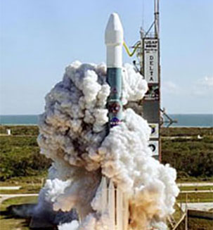
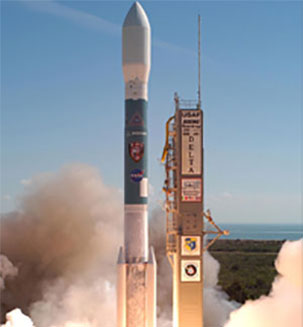
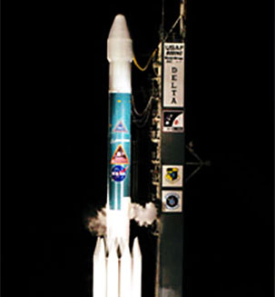
Vandenberg Air Force Base, CA (July 2, 2014) – An United Launch Alliance (ULA) Delta II rocket was successfully launched with NASA's Orbiting Carbon Observatory-2 (OCO-2). OCO-2, is expected to provide insight into how the planet adjusts to the increased production of carbon dioxide from a vantage point in orbit taking readings on a scale never achieved before.
https://images-assets.nasa.gov/video/lsp_oco-2/lsp_oco-2~orig.mp4
https://public.ksc.nasa.gov/lsphistory/wp-content/uploads/sites/26/2023/05/lsp_oco-2.vtt
Cape Canaveral Air Force Station, Fla. (Jan. 23, 2014) – A United Launch Alliance (ULA) Atlas V rocket successfully launched NASA’s Tracking and Data Relay Satellite (TDRS-L) payload at 9:33 p.m. EST today from Space Launch Complex-41. This was the first of 15 ULA launches scheduled for 2014 and the 78th ULA launch for ULA in just over seven years. NASA established the TDRS project in 1973, with the first launch in 1983, to provide around-the-clock and around-the-Earth communications for the network that routes voice calls, telemetry streams and television signals from the International Space Station, as well as telemetry and science data from the Hubble Space Telescope and other orbiting spacecraft.
https://images-assets.nasa.gov/video/lsp_tdrs-l/lsp_tdrs-l~orig.mp4
https://public.ksc.nasa.gov/lsphistory/wp-content/uploads/sites/26/2023/05/lsp_tdrs-l.vtt
CAPE CANAVERAL, Fla. - The United Launch Alliance Atlas V rocket carrying NASA's Mars Atmosphere and Volatile Evolution, or MAVEN, spacecraft lifts off Space Launch Complex 41 on Cape Canaveral Air Force Station in Florida. Launch was on schedule at 1:28 p.m. EST Nov. 18 at the opening of a two-hour launch window. After a 10-month journey to the Red Planet, MAVEN will study its upper atmosphere in unprecedented detail from orbit above the planet. Built by Lockheed Martin in Littleton, Colo., MAVEN will arrive at Mars in September 2014 and will be inserted into an elliptical orbit with a high point of 3,900 miles, swooping down to as close as 93 miles above the planet's surface.
The spacecraft was successfully launched at 11:27 p.m. EDT Friday, Sept. 6, from Pad 0B at the Mid-Atlantic Regional Spaceport, at NASA's Wallops Flight Facility, Wallops Island, Va. LADEE is on its way to arrive at the moon in 30 days, then enter lunar orbit.
https://images-assets.nasa.gov/video/lsp_ladee/lsp_ladee~orig.mp4
https://public.ksc.nasa.gov/lsphistory/wp-content/uploads/sites/26/2023/05/lsp_ladee.vtt
NASA's Interface Region Imaging Spectrograph (IRIS) spacecraft launched Wednesday at 7:27 p.m. PDT (10:27 p.m. EDT) from Vandenberg Air Force Base, Calif. The mission to study the solar atmosphere was placed in orbit by an Orbital Sciences Corporation Pegasus XL rocket.
https://images-assets.nasa.gov/video/lsp_iris/lsp_iris~orig.mp4
https://public.ksc.nasa.gov/lsphistory/wp-content/uploads/sites/26/2023/05/lsp_iris.vtt
The Landsat Data Continuity Mission (LDCM) is the future of Landsat satellites. It will continue to obtain valuable data and imagery to be used in agriculture, education, business, science, and government. The Landsat Program provides repetitive acquisition of high resolution multispectral data of the Earth's surface on a global basis.
https://images-assets.nasa.gov/video/lsp_ldcm/lsp_ldcm~orig.mp4
https://public.ksc.nasa.gov/lsphistory/wp-content/uploads/sites/26/2023/05/lsp_ldcm.vtt
NASA's Tracking and Data Relay Satellite-K or TDRS-K, began its climb to orbit at 8:48 p.m. EST. The TDRS-K spacecraft is part of the next-generation series in the Tracking and Data Relay Satellite System, a constellation of space-based communication satellites providing tracking, telemetry, command and high-bandwidth data return services.
https://images-assets.nasa.gov/video/lsp_tdrs-k/lsp_tdrs-k~orig.mp4
https://public.ksc.nasa.gov/lsphistory/wp-content/uploads/sites/26/2023/05/lsp_tdrs-k.vtt
The engines ignite under the United Launch Alliance Atlas V rocket at 4:05 a.m. EDT lifting NASA's Radiation Belt Storm Probes, or RBSP, off Space Launch Complex 41 on Cape Canaveral Air Force Station in Florida. RBSP will explore changes in Earth's space environment caused by the sun -- known as 'space weather' -- that can disable satellites, create power-grid failures and disrupt GPS service.
NASA’s Nuclear Spectroscopic Telescope Array, or NuSTAR, will use a unique set of “eyes” to see the highest energy X-ray light from the cosmos to reveal black holes lurking in our Milky Way galaxy, as well as those hidden in the hearts of faraway galaxies.
The United Launch Alliance Atlas V rocket carrying NASA's Mars Science Laboratory (MSL) spacecraft lifts off from Space Launch Complex-41 at Cape Canaveral Air Force Station in Florida at 10:02 a.m. EST Nov. 26. MSL's components include a car-sized rover, Curiosity, which has 10 science instruments designed to search for signs of life, including methane, and help determine if the gas is from a biological or geological source.
https://images-assets.nasa.gov/video/lsp_msl/lsp_msl~orig.mp4
https://public.ksc.nasa.gov/lsphistory/wp-content/uploads/sites/26/2023/05/lsp_msl.vtt
At Space Launch Complex-2 on Vandenberg Air Force Base in California, an exhaust cloud builds around the United Launch Alliance Delta II rocket carrying NASA's National Polar-orbiting Operational Environmental Satellite System Preparatory Project (NPP) into space. Liftoff was at 2:48 a.m. PDT. NPP represents a critical first step in building the next-generation of Earth-observing satellites.
https://images-assets.nasa.gov/video/ksc_022212_lsp_npp/ksc_022212_lsp_npp~orig.mp4
https://public.ksc.nasa.gov/lsphistory/wp-content/uploads/sites/26/2023/05/ksc_022212_lsp_npp.vtt
Flames and smoke from the engines surround the United Launch Alliance Delta II rocket at liftoff carrying NASA's twin Gravity Recovery and Interior Laboratory (GRAIL) mission off Space Launch Complex 17B on Cape Canaveral Air Force Station in Florida. The spacecraft launched at 9:08:52 a.m. EDT Sept. The spacecrafts are embarking on a three-month journey to reach the moon.
https://images-assets.nasa.gov/video/ksc_022312_lsp_grail/ksc_022312_lsp_grail~orig.mp4
https://public.ksc.nasa.gov/lsphistory/wp-content/uploads/sites/26/2023/05/ksc_022312_lsp_grail.vtt
Rising from fire and smoke, NASA's Juno planetary probe, enclosed in its payload fairing, launches atop a United Launch Alliance Atlas V rocket. The spacecraft will embark on a five-year journey to Jupiter. The solar-powered spacecraft will orbit Jupiter's poles 33 times to find out more about the gas giant's origins, structure, atmosphere and magnetosphere and investigate the existence of a solid planetary core.
https://images-assets.nasa.gov/video/ksc_022312_lsp_juno/ksc_022312_lsp_juno~orig.mp4
https://public.ksc.nasa.gov/lsphistory/wp-content/uploads/sites/26/2023/05/ksc_022312_lsp_juno.vtt
NASA's Aquarius instrument is part of the SAC-D spacecraft built by CONAE, Argentina's space agency. The mission is expected to gather global measurements of ocean surface salinity, leading to a better understanding. The launch is managed by NASA’s Launch Services Program based at Kennedy Space Center.
https://images-assets.nasa.gov/video/ksc_022212_lsp_aquarius/ksc_022212_lsp_aquarius~orig.mp4
https://public.ksc.nasa.gov/lsphistory/wp-content/uploads/sites/26/2023/05/ksc_022212_lsp_aquarius.vtt
NASA's Glory mission launched from Vandenberg Air Force Base in California on Friday, March 4 at 5:09:45 a.m. EST failed to reach orbit. Telemetry indicated the fairing, the protective shell atop the Taurus XL rocket, did not separate as expected about three minutes after launch. The satellite was intended to improve our understanding of how the sun and tiny atmospheric particles called aerosols affect Earth's climate.
https://images-assets.nasa.gov/video/LSP_Glory/LSP_Glory~orig.mp4
https://public.ksc.nasa.gov/lsphistory/wp-content/uploads/sites/26/2023/05/LSP_Glory.vtt
NASA's Solar Dynamics Observatory was launched successfully by the United Launch Alliance Atlas V rocket on Feb. 11 at 10:23:00 a.m. EST.
https://images-assets.nasa.gov/video/ksc_052510_lsp_sdo/ksc_052510_lsp_sdo~orig.mp4
https://public.ksc.nasa.gov/lsphistory/wp-content/uploads/sites/26/2023/05/ksc_052510_lsp_sdo.vtt
A United Launch Alliance Delta II rocket with NASA’s Wide-field Infrared Survey Explorer (WISE) satellite launches at 6:09 a.m. PST from Space Launch Complex-2 here. WISE will scan the entire sky in infrared light, picking up the glow of hundreds of millions of objects and producing millions of images.
https://images-assets.nasa.gov/video/ksc_052510_lsp_wise/ksc_052510_lsp_wise~orig.mp4
https://public.ksc.nasa.gov/lsphistory/wp-content/uploads/sites/26/2023/05/ksc_052510_lsp_wise.vtt
Smoke billows around the United Launch Alliance Delta II rocket as it launches into space carrying the Space Tracking and Surveillance System - Demonstrator, or STSS-Demo, spacecraft. STSS-Demo was launched at 8:20:22 a.m. EDT by NASA for the U.S. Missile Defense Agency.
https://images-assets.nasa.gov/video/ksc_071610_lsp_stss/ksc_071610_lsp_stss~orig.mp4
https://public.ksc.nasa.gov/lsphistory/wp-content/uploads/sites/26/2023/05/ksc_071610_lsp_stss.vtt
Trailing a column of fire, the Atlas V/Centaur carrying NASA's Lunar Reconnaissance Orbiter, or LRO, and NASA's Lunar Crater Observation and Sensing Satellite, known as LCROSS, hurtles off Launch Complex 41 at Cape Canaveral Air Force Station in Florida. Launch was on-time at 5:32 p.m. EDT.
https://images-assets.nasa.gov/video/ksc_071610_lsp_lrolcross/ksc_071610_lsp_lrolcross~orig.mp4
https://public.ksc.nasa.gov/lsphistory/wp-content/uploads/sites/26/2023/05/ksc_071610_lsp_lrolcross.vtt
A United Launch Alliance Delta II rocket blasts off from Space Launch Complex-2 launch pad at Vandenberg AFB, Calif., at 1:24 p.m. PDT. The Delta II successfully carried the Missile Defense Agency's Space Tracking and Surveillance System (STSS) Advanced Technology Risk Reduction (ATRR) payload into orbit.
https://images-assets.nasa.gov/video/ksc_102810_lsp_stss/ksc_102810_lsp_stss~orig.mp4
https://public.ksc.nasa.gov/lsphistory/wp-content/uploads/sites/26/2023/05/ksc_102810_lsp_stss.vtt
NASA's OCO satellite to study atmospheric carbon dioxide launched aboard a Taurus XL rocket from Vandenberg Air Force Base in CA on Feb. 24 at 1:55 a.m. PST, but it failed to reach orbit. The Mishap Investigation Board verified that the Taurus launch vehicle fairing failed to separate upon command. The failure to shed the fairing mass prevented the satellite from reaching its orbit and resulted in its destruction.
https://images-assets.nasa.gov/video/ksc_102810_lsp_oco/ksc_102810_lsp_oco~orig.mp4
https://public.ksc.nasa.gov/lsphistory/wp-content/uploads/sites/26/2023/05/ksc_102810_lsp_oco.vtt
The Kepler spacecraft lifted off March 6, 2009 aboard a Delta II rocket from Cape Canaveral Air Force Station in Florida. Launch occurred at 10:49 p.m. EST. The Kepler Mission is specifically designed to survey our region of the Milky Way galaxy to discover hundreds of Earth-size and smaller planets.
https://images-assets.nasa.gov/video/ksc_092010_lsp_kepler/ksc_092010_lsp_kepler~orig.mp4
https://public.ksc.nasa.gov/lsphistory/wp-content/uploads/sites/26/2023/05/ksc_092010_lsp_kepler.vtt
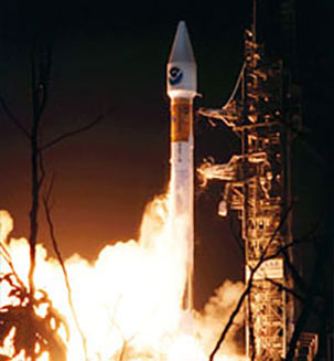
The United Launch Alliance Delta II rocket carrying the NOAA-N Prime weather satellite launched at 2:22 a.m. PST after two consecutive days of launch scrubs. The satellite successfully separated from the rocket's second stage 65 minutes after launch. NOAA-N Prime now is in its circular polar orbit about 534 miles, or 464 nautical miles, above Earth.
https://images-assets.nasa.gov/video/ksc_111510_lsp_noaa_n_prime/ksc_111510_lsp_noaa_n_prime~orig.mp4
https://public.ksc.nasa.gov/lsphistory/wp-content/uploads/sites/26/2023/05/ksc_111510_lsp_noaa_n_prime.vtt
XNASA's Interstellar Boundary Explorer mission, or IBEX, successfully launched from the Kwajalein Atoll in the Pacific Ocean at 1:47 p.m. EDT, Sunday. IBEX will be the first spacecraft to image and map dynamic interactions taking place in the outer solar system.
https://images-assets.nasa.gov/video/ksc_102810_lsp_ibex/ksc_102810_lsp_ibex~orig.mp4
https://public.ksc.nasa.gov/lsphistory/wp-content/uploads/sites/26/2023/05/ksc_102810_lsp_ibex.vtt
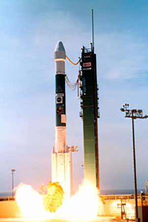
Ocean Surface Topography Mission/Jason-2 satellite launched aboard a Delta II rocket from Space Launch Complex 2 at Vandenberg AFB, California at 12:46 a.m. PDT. The OSTM/Jason-2 satellite will embark on a globe-circling voyage to continue charting sea level, a vital indicator of global climate change. The mission will return a vast amount of new data that will improve weather, climate and ocean forecasts.
https://images-assets.nasa.gov/video/ksc_101510_lsp_ostm/ksc_101510_lsp_ostm~orig.mp4
https://public.ksc.nasa.gov/lsphistory/wp-content/uploads/sites/26/2023/05/ksc_101510_lsp_ostm.vtt
GLAST, the Gamma-ray Large Area Space Telescope, is NASA's next-generation mission designed to explore the most energetic phenomena in our universe.
https://images-assets.nasa.gov/video/ksc_102810_lsp_glast/ksc_102810_lsp_glast~orig.mp4
https://public.ksc.nasa.gov/lsphistory/wp-content/uploads/sites/26/2023/05/ksc_102810_lsp_glast.vtt
The Dawn spacecraft will launch on a Delta II 7925H rocket to investigate two of the largest protoplanets in the main Asteroid Belt, Vesta and Ceres. Dawn's mission is to understand more about the two protoplanets.
https://images-assets.nasa.gov/video/ksc_120310_lsp_dawn/ksc_120310_lsp_dawn~orig.mp4
https://public.ksc.nasa.gov/lsphistory/wp-content/uploads/sites/26/2023/05/ksc_120310_lsp_dawn.vtt
Phoenix is the first in NASA's "Scout Program" and part of the NASA's Mars Exploration Program. Phoenix will provide ground true for the Gamma Ray Spectrometer (GRS) detected water reservoirs that appear to lie within close reach of the surface.
https://images-assets.nasa.gov/video/ksc_120310_lsp_phoenix/ksc_120310_lsp_phoenix~orig.mp4
https://public.ksc.nasa.gov/lsphistory/wp-content/uploads/sites/26/2023/05/ksc_120310_lsp_phoenix.vtt
NASA will launch the Aeronomy of Ice in the Mesosphere (AIM) satellite to orbit the earth for at least two years using a Pegasus XL launch vehicle. The satellite will have three instruments to study the highest clouds in earth's atmosphere which are located at the edge of space.
https://images-assets.nasa.gov/video/ksc_120310_lsp_aim/ksc_120310_lsp_aim~orig.mp4
https://public.ksc.nasa.gov/lsphistory/wp-content/uploads/sites/26/2023/05/ksc_120310_lsp_aim.vtt
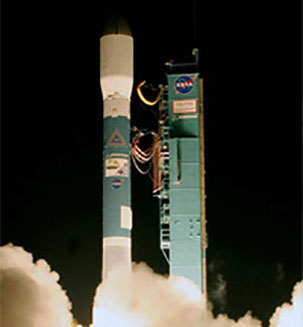
Time History of Events and Macroscale Interactions during Substorms (THEMIS) is a 2-year mission employing five identical micro spacecraft (probes) launched aboard a Delta II 7925-10 from Cape Canaveral Air Force Station, Florida. These probes will track the aurora-dynamic, colorful eruptions in high latitude areas.
https://images-assets.nasa.gov/video/ksc_120310_lsp_themis/ksc_120310_lsp_themis~orig.mp4
https://public.ksc.nasa.gov/lsphistory/wp-content/uploads/sites/26/2023/05/ksc_120310_lsp_themis.vtt
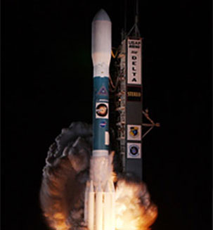
Solar Terrestrial Relations Observatory (STEREO) is a 2-year mission employing two nearly identical observatories, launched aboard a Delta 7925-10L rocket, one ahead of Earth in its orbit, the other trailing behind, to provide 3-D measurements of the Sun and its flow of energy.
https://images-assets.nasa.gov/video/ksc_122010_lsp_stereo/ksc_122010_lsp_stereo~orig.mp4
https://public.ksc.nasa.gov/lsphistory/wp-content/uploads/sites/26/2023/05/ksc_122010_lsp_stereo.vtt
The Cloud-Aerosol Lidar and Infrared Pathfinder Satellite Observations (CALIPSO) satellite helps scientists answer significant questions and provide new information about the effects of clouds and aerosols (airborne particles) on changes in the Earth's climate.
https://images-assets.nasa.gov/video/ksc_122010_lsp_calipso/ksc_122010_lsp_calipso~orig.mp4
https://public.ksc.nasa.gov/lsphistory/wp-content/uploads/sites/26/2023/05/ksc_122010_lsp_calipso.vtt
ST-5 is a pathfinder for future science missions by demonstrating the benefits of a constellation of small low-cost spacecraft obtaining simultaneous measurements in different locations.
https://images-assets.nasa.gov/video/ksc_122010_lsp_st5/ksc_122010_lsp_st5~orig.mp4
https://public.ksc.nasa.gov/lsphistory/wp-content/uploads/sites/26/2023/05/ksc_122010_lsp_st5.vtt
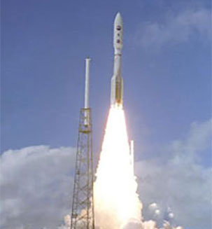
New Horizons will examine Pluto's and Charon's global geology and geomorphology, map their surface compositions and temperatures, and examine Pluto's complex atmosphere.
https://images-assets.nasa.gov/video/ksc_122010_lsp_pluto/ksc_122010_lsp_pluto~orig.mp4
https://public.ksc.nasa.gov/lsphistory/wp-content/uploads/sites/26/2023/05/ksc_122010_lsp_pluto.vtt
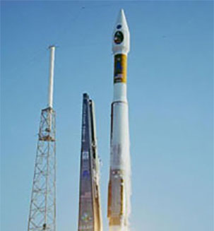
Mars Reconnaissance Orbiter (MRO) will characterize the surface, subsurface, and atmosphere of Mars, and will identify potential landing sites for future missions.
https://images-assets.nasa.gov/video/ksc_012611_lsp_mro/ksc_012611_lsp_mro~orig.mp4
https://public.ksc.nasa.gov/lsphistory/wp-content/uploads/sites/26/2023/05/ksc_012611_lsp_mro.vtt
NOAA-N is one of the National Oceanic and Atmospheric Administration's ongoing series of polar-orbiting weather satellites.
https://images-assets.nasa.gov/video/ksc_012611_lsp_noaa-n/ksc_012611_lsp_noaa-n~orig.mp4
https://public.ksc.nasa.gov/lsphistory/wp-content/uploads/sites/26/2023/05/ksc_012611_lsp_noaa-n.vtt
The Demonstration of Autonomous Rendezvous Technology (DART) vehicle tests the technologies developed to autonomously rendezvous with an on-orbit spacecraft. DART demonstrated technologies allows a space vehicle to locate and dock with another spacecraft without direct human guidance.
https://images-assets.nasa.gov/video/ksc_040811_lsp_dart/ksc_040811_lsp_dart~orig.mp4
https://public.ksc.nasa.gov/lsphistory/wp-content/uploads/sites/26/2023/05/ksc_040811_lsp_dart.vtt
The dual spacecraft mission will collect images and spectra of the impact and its aftermath from the impactor, and images from the fly by spacecraft from ground and space based observatories. Results from Deep Impact mission will lead to a better understanding not only of the solar system's formation but that of some of the solar system's most flamboyant constituents - comets.
https://images-assets.nasa.gov/video/ksc_012611_lsp_deep_impact/ksc_012611_lsp_deep_impact~orig.mp4
https://public.ksc.nasa.gov/lsphistory/wp-content/uploads/sites/26/2023/05/ksc_012611_lsp_deep_impact.vtt
Swift has the tools needed to address many of the key questions we have about gamma-ray bursts. Swift's Burst Alert telescope (BAT) will detect gamma-ray bursts of high energy emission and transmit their locations to both on-board and ground systems so that other telescopes (ground and space assets) can make coordinated observations.
https://images-assets.nasa.gov/video/ksc_041411_lsp_swift/ksc_041411_lsp_swift~orig.mp4
https://public.ksc.nasa.gov/lsphistory/wp-content/uploads/sites/26/2023/05/ksc_041411_lsp_swift.vtt
(Mercury Surface, Space, ENvironment, GEochemistry, and Ranging) is the first scientific investigation of the planet Mercury from orbit. MESSENGER's results will ultimately help us to understand how the terrestrial planets - including Earth - formed.
https://images-assets.nasa.gov/video/ksc_041411_lsp_messenger/ksc_041411_lsp_messenger~orig.mp4
https://public.ksc.nasa.gov/lsphistory/wp-content/uploads/sites/26/2023/05/ksc_041411_lsp_messenger.vtt
Aura is a NASA mission to study the Earth's ozone, air quality and climate. This mission is designed exclusively to conduct research on the composition, chemistry and dynamics of the Earth's upper and lower atmosphere employing multiple instruments on a single satellite.
https://images-assets.nasa.gov/video/ksc_040811_lsp_aura/ksc_040811_lsp_aura~orig.mp4
https://public.ksc.nasa.gov/lsphistory/wp-content/uploads/sites/26/2023/05/ksc_040811_lsp_aura.vtt
GPB is a relativity gyroscope experiment developed by Stanford University, Lockheed Martin and NASA's Marshall Space Flight Center to test two extraordinary predictions of Albert Einstein's general theory of relativity, the geodetic effect and frame dragging.
https://images-assets.nasa.gov/video/ksc_041411_lsp_gpb/ksc_041411_lsp_gpb~orig.mp4
https://public.ksc.nasa.gov/lsphistory/wp-content/uploads/sites/26/2023/05/ksc_041411_lsp_gpb.vtt
Space Infrared Telescope Facility (SIRTF) is the infrared component of NASA"s family of great observatories, and will study a wide variety of astronomical phenomena, extending from our solar system to the distant reaches of the early universe.
https://images-assets.nasa.gov/video/ksc_083011_lsp_sirtf/ksc_083011_lsp_sirtf~orig.mp4
https://public.ksc.nasa.gov/lsphistory/wp-content/uploads/sites/26/2023/05/ksc_083011_lsp_sirtf.vtt
The scientific mission of SCISAT-1/ACE (Atmospheric Chemistry Experiment) is to measure and understand the chemical processes that control the distribution of ozone in the Earth's atmosphere, particularly at high latitudes.
https://images-assets.nasa.gov/video/ksc_083011_lsp_scisat/ksc_083011_lsp_scisat~orig.mp4
https://public.ksc.nasa.gov/lsphistory/wp-content/uploads/sites/26/2023/05/ksc_083011_lsp_scisat.vtt
Opportunity - The robotic explorers will trek up to 40 meters across the surface in a Martian day. Each rover will carry a sophisticated set of instruments that will allow it to search for evidence of liquid water that may have been present in the planet's past.
https://images-assets.nasa.gov/video/ksc_083011_lsp_mer-b/ksc_083011_lsp_mer-b~orig.mp4
https://public.ksc.nasa.gov/lsphistory/wp-content/uploads/sites/26/2023/05/ksc_083011_lsp_mer-b.vtt
Spirit Mars Exploration Rover - The robotic explorers will trek up to 40 meters across the surface in a Martian day. Each rover will carry a sophisticated set of instruments that will allow it to search for evidence of liquid water that may have been present in the planet's past.
https://images-assets.nasa.gov/video/ksc_083011_lsp_mer-a/ksc_083011_lsp_mer-a~orig.mp4
https://public.ksc.nasa.gov/lsphistory/wp-content/uploads/sites/26/2023/05/ksc_083011_lsp_mer-a.vtt
GALEX, the Galaxy Evolution Explorer, is a NASA Ultraviolet imaging and spectroscope survey mission designed to map the global history and probe the causes of star formation. Understanding how the galaxies were formed is its main mission.
https://images-assets.nasa.gov/video/ksc_081111_lsp_galex/ksc_081111_lsp_galex~orig.mp4
https://public.ksc.nasa.gov/lsphistory/wp-content/uploads/sites/26/2023/05/ksc_081111_lsp_galex.vtt
The Solar Radiation and Climate Experiment (SORCE) will provide NASA's Earth Science Enterprise (ESE) with precise measurements of solar radiation. In order to understand mankind's roles in climate change, the Sum's impact must first be understood.
https://images-assets.nasa.gov/video/ksc_081111_lsp_sorce/ksc_081111_lsp_sorce~orig.mp4
https://public.ksc.nasa.gov/lsphistory/wp-content/uploads/sites/26/2023/05/ksc_081111_lsp_sorce.vtt
Ice, Cloud, and Land Elevation Satellite / Cosmic Hot Interstellar Plasma Satellite. The ICESat mission will provide cloud property information not otherwise available from passive sensors, especially the high ice clouds common over polar areas. The Cosmic Hot Interstellar Plasma Satellite (CHIPS) is a satellite-based observatory, scheduled to study the million degrees gas in the Interstellar Medium.
https://images-assets.nasa.gov/video/ksc_083011_lsp_icesat_chipsat/ksc_083011_lsp_icesat_chipsat~orig.mp4
https://public.ksc.nasa.gov/lsphistory/wp-content/uploads/sites/26/2023/05/ksc_083011_lsp_icesat_chipsat.vtt
The objective of the Replenishment Spacecraft is to continue Space Networking tracking, data, voice and video services to NASA scientific satellites, the Shuttle, International Space Station, and to other NASA customers by replenishing the current constellation of geosynchronous TDRS satellites.
https://images-assets.nasa.gov/video/ksc_092211_lsp_tdrs-j/ksc_092211_lsp_tdrs-j~orig.mp4
https://public.ksc.nasa.gov/lsphistory/wp-content/uploads/sites/26/2023/05/ksc_092211_lsp_tdrs-j.vtt
The CONTOUR mission is designed to greatly add to our understanding of comet nuclei and their diversity because comets are the most pristine, primitive,and evidentiary bodies in the solar system.
The Comet Nucleus Tour, or CONTOUR, mission is timed to encounter and study at least two comets as they make their periodic visits to the inner solar system.
https://images-assets.nasa.gov/video/ksc_091611_lsp_contour/ksc_091611_lsp_contour~orig.mp4
https://public.ksc.nasa.gov/lsphistory/wp-content/uploads/sites/26/2023/05/ksc_091611_lsp_contour.vtt
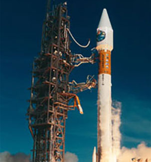
The spacecraft will continue to provide a polar-orbiting platform to support the environmental monitoring instruments for imaging and measurement of the earth's atmosphere, including earth radiation, atmospheric ozone, aerosol distribution, sea surface temperature, vertical temperature, and water profiles in the troposphere and stratosphere.
https://images-assets.nasa.gov/video/ksc_091611_lsp_noaa-m/ksc_091611_lsp_noaa-m~orig.mp4
https://public.ksc.nasa.gov/lsphistory/wp-content/uploads/sites/26/2023/05/ksc_091611_lsp_noaa-m.vtt
The major science objectives of the EOS Aqua mission are the study of cloud coverage and properties, atmospheric temperatures and humidities, trace gases and aerosols in the atmosphere, precipitation, radiative energy balances, terrestrial snow, sea ice, sea surface temperature, land vegetation, and ocean productivity.
https://images-assets.nasa.gov/video/ksc_091611_lsp_aqua/ksc_091611_lsp_aqua~orig.mp4
https://public.ksc.nasa.gov/lsphistory/wp-content/uploads/sites/26/2023/05/ksc_091611_lsp_aqua.vtt
The objective of the Replenishment Spacecraft is to continue Space Networking tracking, data, voice and video services to NASA scientific satellites, the Shuttle, International Space Station, and to other NASA customers by replenishing the current constellation of geosynchronous TDRS satellites.
https://images-assets.nasa.gov/video/ksc_092211_lsp_tdrs-i/ksc_092211_lsp_tdrs-i~orig.mp4
https://public.ksc.nasa.gov/lsphistory/wp-content/uploads/sites/26/2023/05/ksc_092211_lsp_tdrs-i.vtt
HESSI, the High Energy Solar Spectroscopic Imager, is a satellite-based observatory of x-rays and gamma rays from the sun. Its primary objective is to explore particle acceleration and energy release in solar flares.
https://images-assets.nasa.gov/video/ksc_092111_lsp_hessi/ksc_092111_lsp_hessi~orig.mp4
https://public.ksc.nasa.gov/lsphistory/wp-content/uploads/sites/26/2023/05/ksc_092111_lsp_hessi.vtt
Jason-1 is a true ocean observatory that will supply sea-state measurements to the international user community. TIMED satellite will measure the Mesosphere, Lower Thermosphere/Ionosphere and scientists will use this cumulative data to predict effects on communication, satellite tracking, spacecraft lifetimes, degradation of spacecraft materials, and re-entry of piloted vehicles.
https://images-assets.nasa.gov/video/ksc_093011_lsp_jason_timed/ksc_093011_lsp_jason_timed~orig.mp4
https://public.ksc.nasa.gov/lsphistory/wp-content/uploads/sites/26/2023/05/ksc_093011_lsp_jason_timed.vtt
When ground based field mills indicate a high electrical potential, a rocket trailing a fine wire that unwinds from a bobbin is shot into the cloud initiating a lightning discharge down the wire.
https://images-assets.nasa.gov/video/ksc_093011_lsp_kodiak_star/ksc_093011_lsp_kodiak_star~orig.mp4
https://public.ksc.nasa.gov/lsphistory/wp-content/uploads/sites/26/2023/05/ksc_093011_lsp_kodiak_star.vtt
The Genesis mission will yield the first samples of extraterrestrial materials returned in the new millennium. These particles of solar wind will provide significant insights for scientists as they interpret the results of other NASA planetary missions.
https://images-assets.nasa.gov/video/ksc_093011_lsp_genesis/ksc_093011_lsp_genesis~orig.mp4
https://public.ksc.nasa.gov/lsphistory/wp-content/uploads/sites/26/2023/05/ksc_093011_lsp_genesis.vtt
The GOES series of satellites is owned and operated by the National Oceanic and Atmospheric Administration (NOAA). Each satellite in the series carries two major instruments: and Image and a Sounder. These instruments acquire high resolution visible and infrared data, as well as temperature and moisture profiles of the atmosphere.
https://images-assets.nasa.gov/video/ksc_093011_lsp_goes/ksc_093011_lsp_goes~orig.mp4
https://public.ksc.nasa.gov/lsphistory/wp-content/uploads/sites/26/2023/05/ksc_093011_lsp_goes.vtt
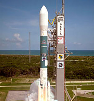
The Microwave Anisotropy Probe (MAP) mission is designed to unravel the mysteries of the content and evolution of the universe. With highly sensitive advanced microwave receivers operating far from the Earth, MAP will measure the details patterns in the afterglow radiation from the Big Bang.
https://images-assets.nasa.gov/video/ksc_092911_lsp_map/ksc_092911_lsp_map~orig.mp4
https://public.ksc.nasa.gov/lsphistory/wp-content/uploads/sites/26/2023/05/ksc_092911_lsp_map.vtt
Odyssey will map minerals and elements on the surface of Mars, study landforms, and evaluate the potential health risks of the Martian radiation environment for any future human explorers.
https://images-assets.nasa.gov/video/ksc_092911_lsp_marsody/ksc_092911_lsp_marsody~orig.mp4
https://public.ksc.nasa.gov/lsphistory/wp-content/uploads/sites/26/2023/05/ksc_092911_lsp_marsody.vtt
The Earth Observing-1 (EO-1) mission, as part of the New Millennium Program (NMP), developed and validated a number of instrument and spacecraft bus breakthrough technologies designed to enable the development of future earth imaging observatories that will have a significant increase in performance while also having reduced cost and mass.
https://images-assets.nasa.gov/video/ksc_093011_lsp_eo1_sacc/ksc_093011_lsp_eo1_sacc~orig.mp4
https://public.ksc.nasa.gov/lsphistory/wp-content/uploads/sites/26/2023/05/ksc_093011_lsp_eo1_sacc.vtt
HETE-2, also known as the High Energy Transient Explorer is an international collaboration between USA, Japan, France, and Italy, headed by the Center for Space Research at MIT. HETE-2 is designed to detect and localize gamma-ray bursts (GRBs).
https://images-assets.nasa.gov/video/ksc_092911_lsp_hete2/ksc_092911_lsp_hete2~orig.mp4
https://public.ksc.nasa.gov/lsphistory/wp-content/uploads/sites/26/2023/05/ksc_092911_lsp_hete2.vtt
Like other NOAA satellites, NOAA-16 will collect meteorological data and transmit the information to users around the world to enhance weather forecasting. In the United States, the data will be used primarily by NOAAs National Weather Service for its long-range weather and climate forecasts.
https://images-assets.nasa.gov/video/ksc_092911_lsp_noaal/ksc_092911_lsp_noaal~orig.mp4
https://public.ksc.nasa.gov/lsphistory/wp-content/uploads/sites/26/2023/05/ksc_092911_lsp_noaal.vtt
The TDRS-H mission was the first of three new enhanced TDRS satellites built for NASA by Boeing Satellite Systems, using modern commercial practices.
https://images-assets.nasa.gov/video/ksc_092211_lsp_tdrs-h/ksc_092211_lsp_tdrs-h~orig.mp4
https://public.ksc.nasa.gov/lsphistory/wp-content/uploads/sites/26/2023/05/ksc_092211_lsp_tdrs-i.vtt
The spacecraft is a three-axis internally stabilized weather satellite that has the dual capability of providing pictures while performing atmospheric sounding at the same time.
https://images-assets.nasa.gov/video/ksc_092911_lsp_goel/ksc_092911_lsp_goel~orig.mp4
https://public.ksc.nasa.gov/lsphistory/wp-content/uploads/sites/26/2023/05/ksc_092911_lsp_goel.vtt
IMAGE is the first satellite mission dedicated to imaging the Earth's magnetosphere, the region of space controlled by the Earth's magnetic field and containing extremely tenuous plasmas of both solar and terrestrial origin.
https://images-assets.nasa.gov/video/ksc_093011_lsp_image/ksc_093011_lsp_image~orig.mp4
https://public.ksc.nasa.gov/lsphistory/wp-content/uploads/sites/26/2023/05/ksc_093011_lsp_image.vtt
Terra carries five state-of-the-art sensors that have been studying the interactions among the Earth's atmosphere, lands, oceans, and radiant energy.
https://images-assets.nasa.gov/video/ksc_101211_lsp_terra/ksc_101211_lsp_terra~orig.mp4
https://public.ksc.nasa.gov/lsphistory/wp-content/uploads/sites/26/2023/05/ksc_101211_lsp_terra.vtt
FUSE is a NASA-supported astrophysics mission that was launched on June 24, 1999, to explore the Universe using the technique of high-resolution spectroscopy in the far-ultraviolet spectral region.
https://images-assets.nasa.gov/video/ksc_101211_lsp_fuse/ksc_101211_lsp_fuse~orig.mp4
https://public.ksc.nasa.gov/lsphistory/wp-content/uploads/sites/26/2023/05/ksc_101211_lsp_fuse.vtt
QuikSCAT was initiated as a "quick recovery" mission to help reduce the ocean-wind vector data gap created by the loss of the NASA Scatterometer (NSCAT) on the Japanese Advanced Earth Observing Satellite (ADEOS), which ceased functioning when ADEOS failed on June 30, 1997.
https://images-assets.nasa.gov/video/ksc_101211_lsp_quickscat/ksc_101211_lsp_quickscat~orig.mp4
https://public.ksc.nasa.gov/lsphistory/wp-content/uploads/sites/26/2023/05/ksc_101211_lsp_quickscat.vtt
TERRIERS will survey the upper atmosphere to allow scientists to better predict space weather conditions that could disrupt communications systems on Earth.
MUBLCOM will demonstrate a new, unique capability to provide space-based digital voice and data communications to combat forces or commercial users that were previously considered out of range of standard radio communications systems.
https://images-assets.nasa.gov/video/ksc_101311_lsp_terriers/ksc_101311_lsp_terriers~orig.mp4
https://public.ksc.nasa.gov/lsphistory/wp-content/uploads/sites/26/2023/05/ksc_101311_lsp_terriers.vtt
The Landsat 7 system will insure continuity of Thematic Mapper type data into the next century.
The earth observing instrument on Landsat 7, the Enhanced Thematic Mapper Plus (ETM+), replicates the capabilities of the highly successful Thematic Mapper instruments on Landsats 4 and 5.
https://images-assets.nasa.gov/video/ksc_101211_lsp_landsat/ksc_101211_lsp_landsat~orig.mp4
https://public.ksc.nasa.gov/lsphistory/wp-content/uploads/sites/26/2023/05/ksc_101211_lsp_landsat.vtt
WIRE is a Small Explorer Mission designed to study the evolution of starburst galaxies and search for distant ultra-luminous galaxies. The instrument consists of a cryogenically-cooled, 30 cm imaging telescope which will detect faint astronomical sources in two infrared wavelength bands.
https://images-assets.nasa.gov/video/ksc_101211_lsp_wire/ksc_101211_lsp_wire~orig.mp4
https://public.ksc.nasa.gov/lsphistory/wp-content/uploads/sites/26/2023/05/ksc_101211_lsp_wire.vtt
Stardust is the first U.S. space mission dedicated solely to the exploration of a comet, and the first robotic mission designed to return extraterrestrial material from outside the orbit of the Moon.
https://images-assets.nasa.gov/video/ksc_101311_lsp_stardust/ksc_101311_lsp_stardust~orig.mp4
https://public.ksc.nasa.gov/lsphistory/wp-content/uploads/sites/26/2023/05/ksc_101311_lsp_stardust.vtt
One of two Mars ’98 missions. The lander was solar-powered and designed to touch down on the Martian surface near the northern-most boundary of the South Pole to study the water cycle there. All communication with the spacecraft was lost on Dec. 3, 1999, after it attempted to land on the planet. Also lost were the Deep Space 2 microprobes aboard.
https://images-assets.nasa.gov/video/ksc_101411_lsp_polarlander/ksc_101411_lsp_polarlander~orig.mp4
https://public.ksc.nasa.gov/lsphistory/wp-content/uploads/sites/26/2023/05/ksc_101411_lsp_polarlander.vtt
The primary objective of SWAS is to survey water, molecular oxygen, carbon, and isotopic carbon monoxide emission in a variety of galactic star forming regions.
https://images-assets.nasa.gov/video/ksc_101411_lsp_swas/ksc_101411_lsp_swas~orig.mp4
https://public.ksc.nasa.gov/lsphistory/wp-content/uploads/sites/26/2023/05/ksc_101411_lsp_swas-1.vtt
One of two Mars ’98 missions. The orbiter was to be used primarily to support its companion, the Mars Polar Lander, by acting as a relay station for data transmissions to and from the lander and Earth, and to collect data about Mars. The spacecraft was lost on Sept. 23, 1999, after the orbiter fired its main engine to go into orbit around the planet.
https://images-assets.nasa.gov/video/ksc_101411_lsp_marsclimate/ksc_101411_lsp_marsclimate~orig.mp4
ksc_101411_lsp_marsclimate.v
Deep Space 1 (DS1), the first of NASA's New Millennium Program missions, tested 12 advanced technologies and instruments in space. DS1's flight testing of new technologies pioneered the way for future spacecraft and missions to have an arsenal of revolutionary technical capabilities for exploring the universe.
https://images-assets.nasa.gov/video/ksc_101311_lsp_deepsat/ksc_101311_lsp_deepsat~orig.mp4
https://public.ksc.nasa.gov/lsphistory/wp-content/uploads/sites/26/2023/05/ksc_101311_lsp_deepsat-1.vtt
